
REMOTE SENSE
Manage your entire drone fleet from anywhere in the world. Cloud, edge servers, and satellite links — one platform, complete control.
Your Fleet.
Anywhere on Earth.
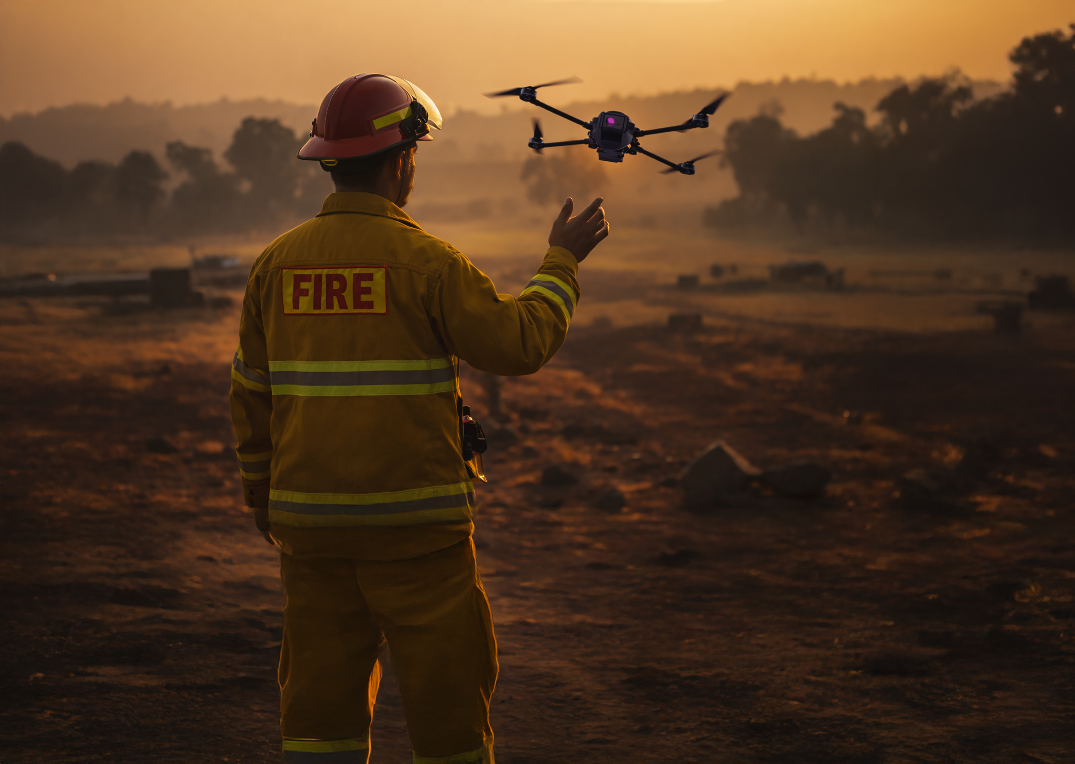
From bushfire response in the Australian outback to offshore infrastructure inspection — connect to every vehicle in your fleet through our cloud servers, regional edge nodes, or satellite uplinks. No location is out of reach.
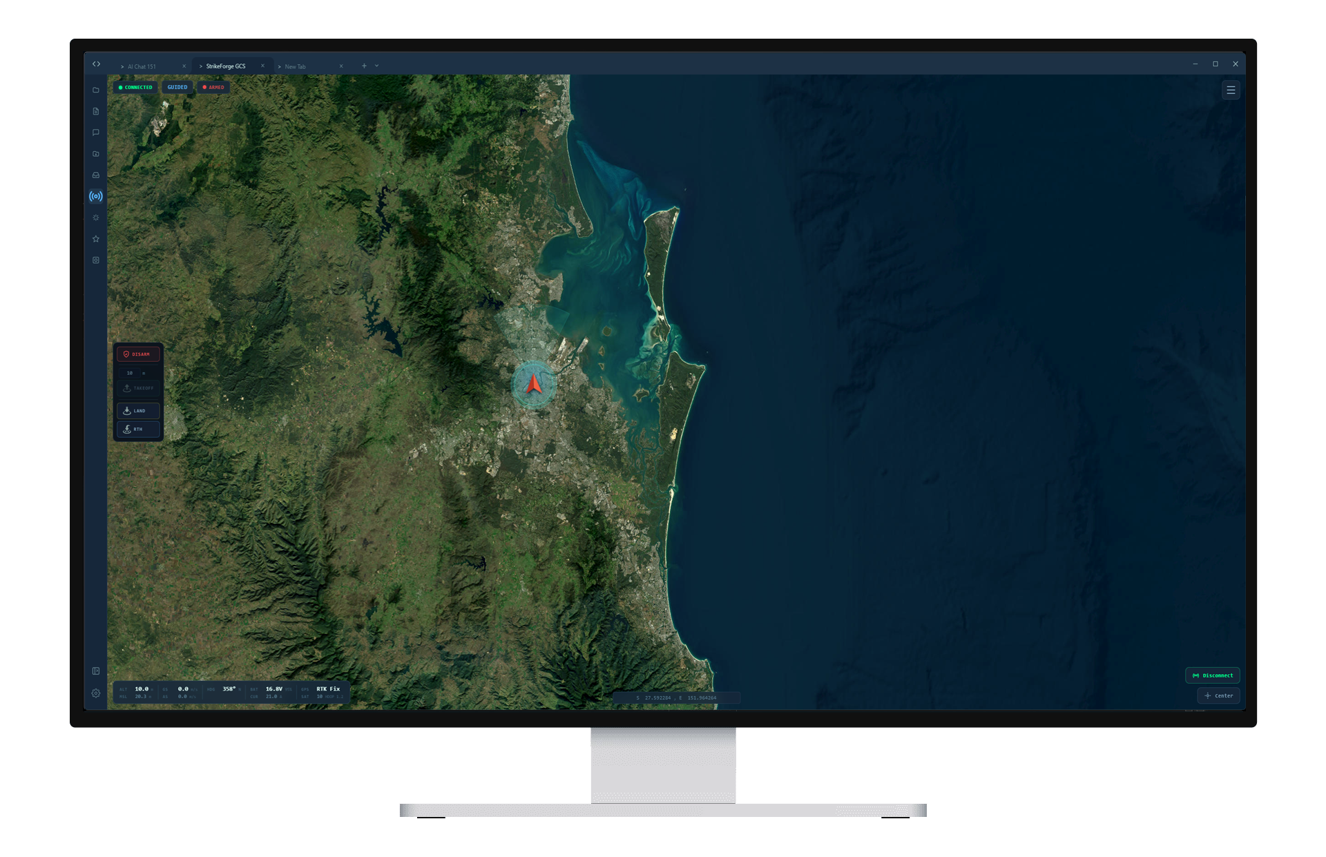
Defense-grade headless ground control station engineered for global fleet management at scale. Connect to vehicles anywhere in the world through our central server, distributed edge nodes, or satellite uplinks — with real-time telemetry, swarm coordination, and full mission control through a unified API and WebSocket interface.
Open StrikeForgeDroneScape
Comprehensive real-time airspace data aggregation platform. 30+ data sources normalised into a single operational picture — NOTAMs with AI-powered classification, live weather & radar, ADS-B traffic monitoring, terrain analysis, fire detection, and full regulatory compliance.
Open DroneScape
Deploy Across Industries
Command Centre Operations
Multi-screen operator workstations with integrated telemetry, mapping, and real-time video feeds.
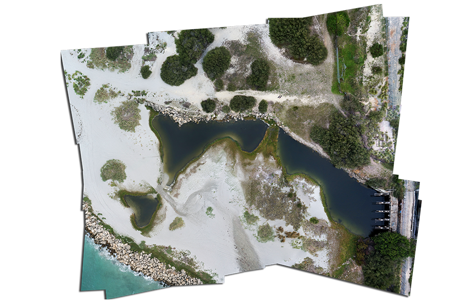
Aerial Survey & Orthomosaics
Precision mapping with automated flight planning and stitched imagery output.
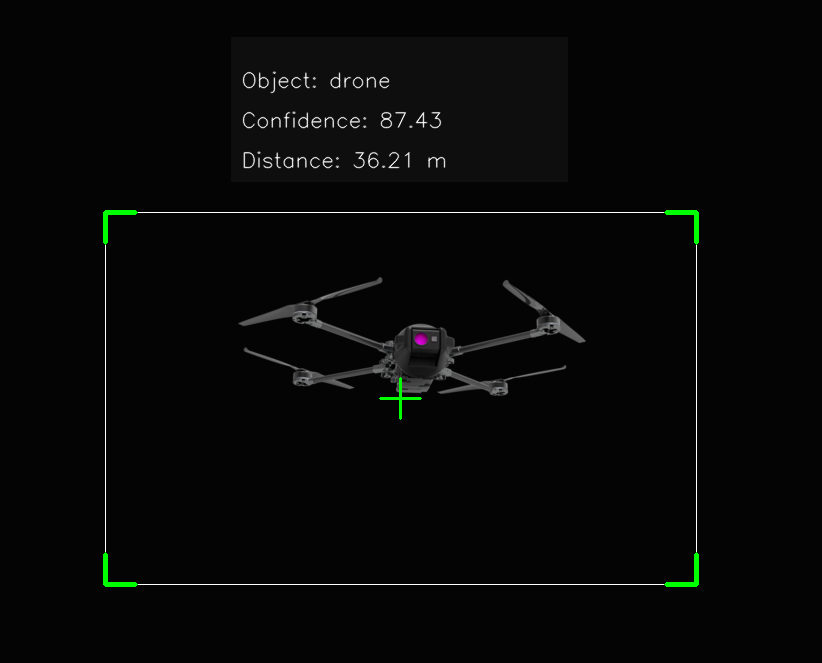
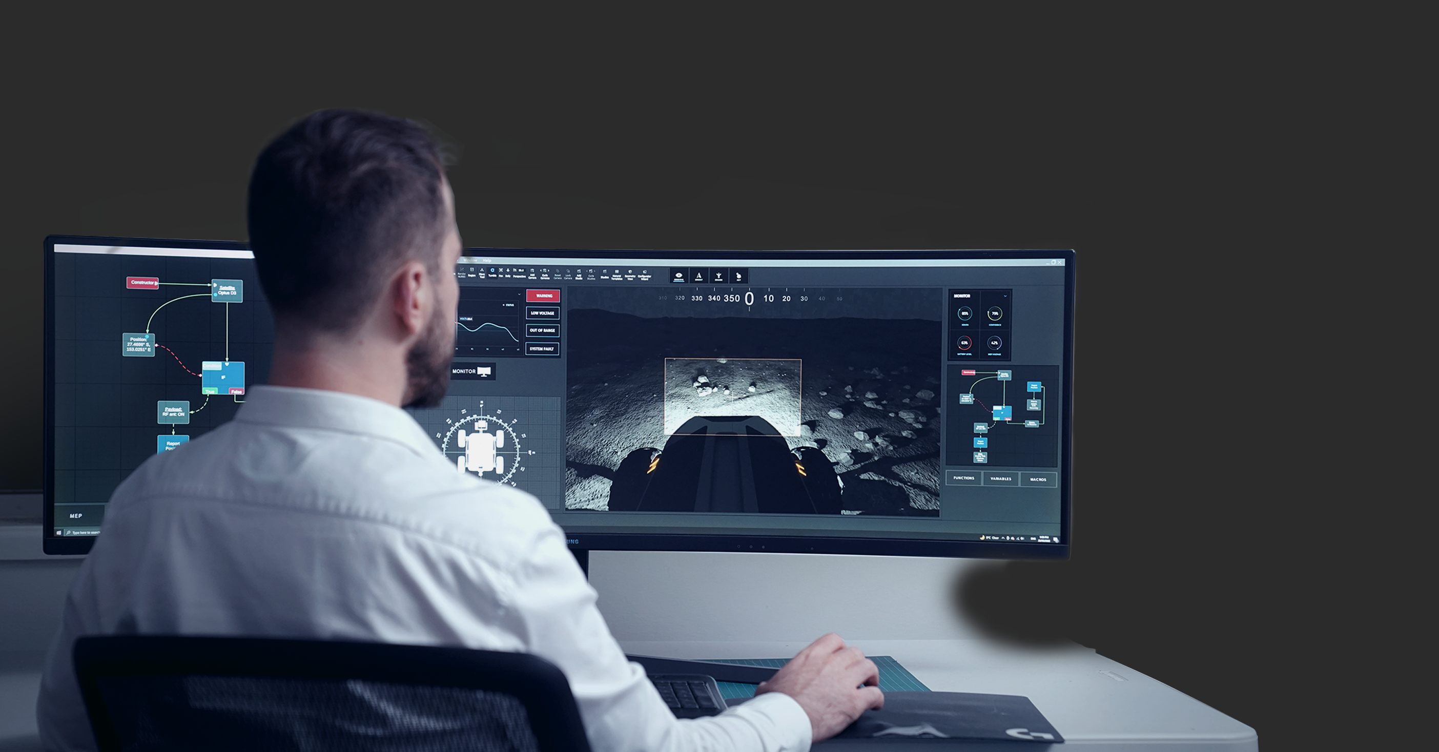
Object Recognition
Real-time classification with confidence scoring and distance estimation.
Built for Real-World
Drone Operations
Global Fleet Control
Manage your entire drone fleet from a single interface — vehicles connect from anywhere on Earth via cloud, edge, or satellite.
Edge Server Network
Deploy lightweight edge nodes at regional operating sites for low-latency local control with central oversight.
Satellite Uplink
Operate in remote and austere environments. Satellite link support keeps your fleet connected where terrestrial networks end.
Swarm Formations
Synchronised multi-vehicle control with configurable formation patterns and coordinated commands at scale.
NOTAM Intelligence
Automated parsing with AI-powered classification, relevance scoring, and temporal filtering from global authorities.
Weather Systems
Real-time METAR, TAF, BOM radar, winds aloft, forecasts, and severe weather warning integration worldwide.
ADS-B Tracking
Live aircraft positions from multiple sources with geofence monitoring and separation analysis.
Terrain Analysis
Copernicus DEM elevation queries, path profiles, and obstacle clearance assessment for any location globally.
Ready to Take Control?
Command your global fleet from a single platform — cloud, edge, or satellite.Total situational awareness, wherever you operate.
Access Platform